MedEWSa presents its early warning framework at IEEE CSR 2026 in Lisbon
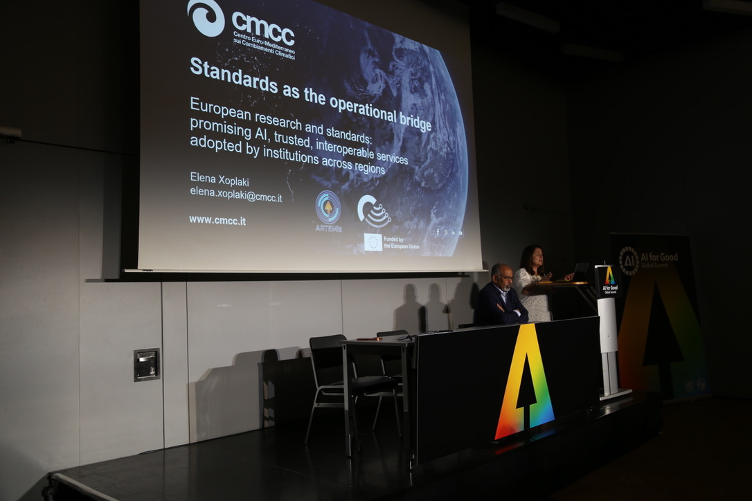
MedEWSa took its science to the IEEE International Conference on Cyber Security and Resilience this week. The conference ran from 3 to 5 August 2026 in Lisbon, Portugal. Elena Xoplaki presented the MedEWSa framework at the CYPRES workshop, the conference track dedicated to critical infrastructure resilience.
The talk made one point clear. Early warning is no longer only a forecasting problem. Climate hazards damage physical assets and disrupt the digital and organisational systems that emergency managers depend on. Heatwaves, floods, droughts, wildfires, storms and coastal flooding can each cascade through power supply, transport, water services and communication networks. MedEWSa builds the information chain that connects environmental data to impact assessment, warning and response.
The core of this chain is the MedEWSa Decision Support and Dissemination System, known as the DSDS. The DSDS does not control infrastructure directly. It links forecast production, impact assessment, warning dissemination and user-oriented decision support into one modular architecture. It connects existing systems such as MeteoAlarm, MyDewetra, SEEMHEWS and AMHEWAS with newly developed services, so that warning capacities across Europe, the Mediterranean and Africa can work together instead of standing apart.
It set out three properties that give the DSDS its value for cyber-physical resilience. Interoperability lets existing systems and new services connect. Interpretability turns dense environmental data into risk information that a decision maker can act on. Continuity of communication keeps warnings flowing even when a crisis disrupts normal channels.
The talk also introduced the MedEWSa Risk Transfer Platform. Before an event, impact-based forecasts are checked against predefined thresholds and validated with real-time observations, so that forecast-based financing or parametric insurance can trigger early action such as evacuation support or emergency supplies. After an event, the same platform guides authorities through a structured application to the European Union Solidarity Fund, organising damage documentation and cost estimates. The platform keeps every forecast, trigger and financial decision traceable in one chain.
Testing this architecture across contrasting settings sits at the heart of the project. MedEWSa runs four paired Twins across eight pilot sites. Attica in Greece pairs with Ethiopian national parks on wildfires and extreme events. Venice pairs with Alexandria and the Nile Delta on coastal floods and storm surges. Košice pairs with Tbilisi on floods and landslides. Catalonia pairs with Sweden on heatwaves, droughts and wildfires. Xoplaki highlighted the Attica pilot in detail, where the enhanced wildfire early warning system now delivers near real time monitoring through Meteosat, ignition point identification down to 300 metres, fire propagation simulation and automated burned scar mapping after an incident.
We have five take-home points.
- Climate hazards challenge physical infrastructure and the information systems that manage emergencies together.
- MedEWSa treats early warning as a cyber-physical information and coordination function.
- The DSDS links forecasting, impact assessment, dissemination and decision support.
- The Twin structure gives the project a practical way to adapt, co-design and validate across different operational contexts.
- The evidence so far supports an architecture that is operationally oriented and still under implementation and validation, not yet a finished system across every Twin.